


Montagnes à la Carte
The cols of the Alpes Maritimes offer some of the best riding in Europe. Providing inspiration and perspiration in close to equal measure. The plethora of roads, routes and rides that the region offers up to any visiting cyclist is innumerable. From hors category climbs to spins by the sea, from breaks for the Italian border to gravel grinds, from classic Cols to unknown tracks.
To salute the roads we ride, we've created a badge for each col. To claim your badge you need to connect your Café du Cycliste account to your komoot account and go out and ride. All badges are free to a good, and deserving home. To learn more and get started on your collection, head to our badges page here.
MADONE D’UTELLE
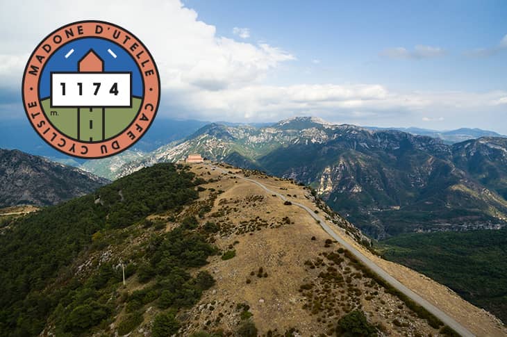
This has long been a place of pilgrimage and healing, but one that for cyclists has remained a well-kept secret – beloved of local riders… until recently. In March 2016, the penultimate stage of Paris-Nice finished on the summit, bringing the views from this holy site to a wider audience.
KEY INFO
Altitude: 1,174m
Length: 15.3km
Ascent: 894m
Average Gradient 5.8%
Max Gradient 8.0%
COL DE LA BONETTE
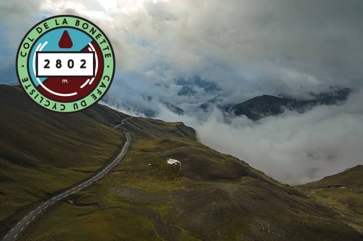
Don’t look too hard at the Bonette’s claim – seen on signposts the length of the ascent from Jausiers in the north and from Saint-Étienne-de-Tinée in the south – that it is the highest road in Europe. Instead, marvel at the panorama in front of you which will make the debate seem inconsequential.
KEY INFO
Altitude: 2,802m
Length: 25.8km
Ascent: 1,652m
Average Gradient 6.4%
Max Gradient 15.0%
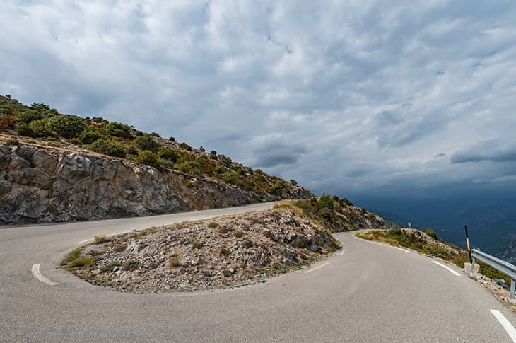
COL DE TENDE
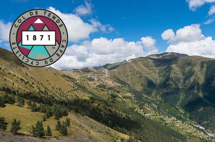
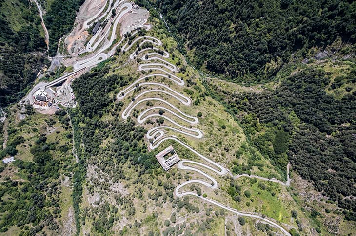
Alpe d’Huez famously has 21 switchbacks, hairpins, or lacets - call them what you want. The Passo dello Stelvio has 48 on the classic eastern side but that’s in 16.5km and all on tarmac. The Col de Tende manages the same number in 7.4km. If you like getting off the beaten track, you will like the Col de Tende.
KEY INFO
Altitude: 1,871m
Length: 7.4km
Ascent: 587m
Average Gradient 8.0%
Max Gradient 18.0%
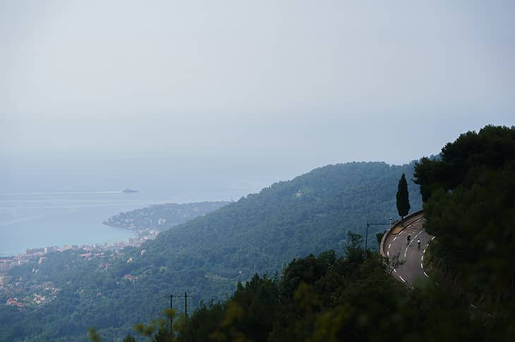
COL D’ÈZE
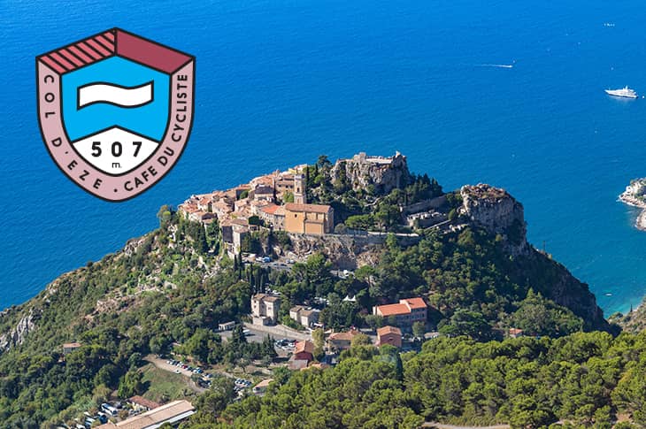
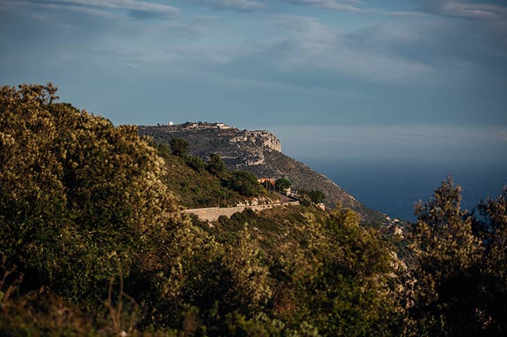
Between Èze village and the fort runs the Route de la Grande Corniche, the highest of the three corniche roads that lead from Nice towards Monaco and Italy. Starting almost at the Café, it takes you steeply out of town, past villas and under palm trees, winding up through the hills to a height of 507m.
KEY INFO
Altitude: 507m
Length: 10.0km
Ascent: 490m
Average Gradient 4.9%
Max Gradient 10.0%
COL DE LA MADONE
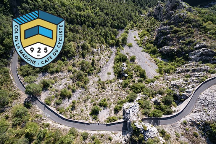
Famed as a training hill, exactly where the pros commence their battle with the clock on the ‘classic’ start is a constant cause of debate. Regardless of how long it takes, a successful summit is rewarded with a view towards Peille and the higher mountains with Madone being a gateway Col that unlocks the door to a whole host of other climbs and routes in the Alpes Maritimes.
KEY INFO
Altitude: 925m
Length: 13.3km
Ascent: 920m
Average Gradient 7.0%
Max Gradient 12.0%
MONT VENTOUX
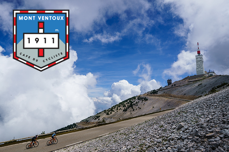
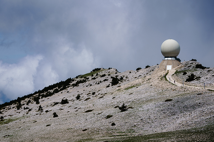
Let us be clear: the road to Ventoux does not go anywhere and there is no reason to climb it. It exists only as a challenge, the ultimate mirror, says cycling philosopher Paul Fournel, in which riders, stripped bare, confront not only the grandeur of nature but also their essential selves. Perhaps this is why the legend of Ventoux endures, and new chapters keep being written.
KEY INFO
Altitude: 1,911m
Length: 22.7km
Ascent: 1,622m
Average Gradient 7.2%
Max Gradient 10.8%
COL DE TURINI
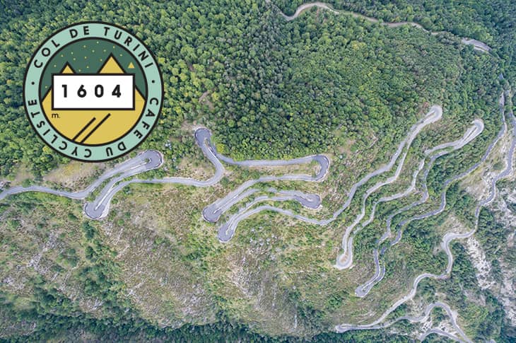
The thick forests of the Col de Turini are testament to the unpredictable weather on this, the highest of the coastal climbs near Café du Cycliste’s home town of Nice. Even close to the top of the heaped switchbacks, the sea can still be glimpsed, and warm, wet, maritime air regularly drifts inland and buffets the mountain, leading to downpours on its slopes
KEY INFO
Altitude: 1,604m
Length: 24.0km
Ascent: 1,244m
Average Gradient 5.2%
Max Gradient 9.3%
COL DE BRAUS
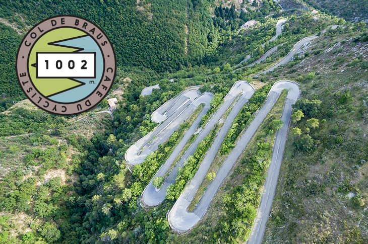
People have been stopping to marvel at this view since the col’s famous switchbacks were constructed in the early 20th century. Take your time up the ascent and you will admire the olive groves, and maybe spy the remnants of the old Route Royale, the salt road that linked Nice and the coast to Piedmont and the Dukes of Savoy in Turin.
KEY INFO
Altitude: 1,002m
Length: 10.3km
Ascent: 662m
Average Gradient 6.4%
Max Gradient 15.0%
COL DE VENCE
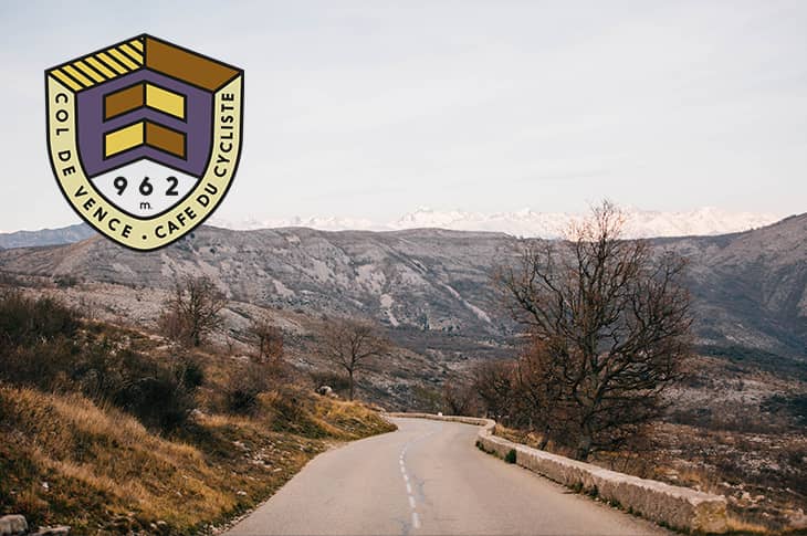
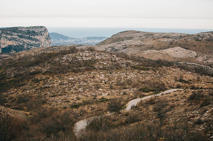
It is said that Alberto Contador rode this 9.7km stretch, which rises 643m and averages 6.6%, in less 24 minutes. Mere mortals who do it in less than 35 should count themselves lucky. If you can tear your eyes off your stem in the final kilometres, you’ll have a great view of the Mediterranean from Italy to Cannes and beyond.
KEY INFO
Altitude: 962m
Length: 9.7km
Ascent: 643m
Average Gradient 6.6%
Max Gradient 9.0%
MONT VIAL
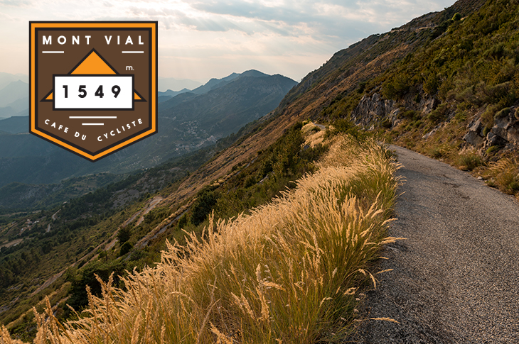
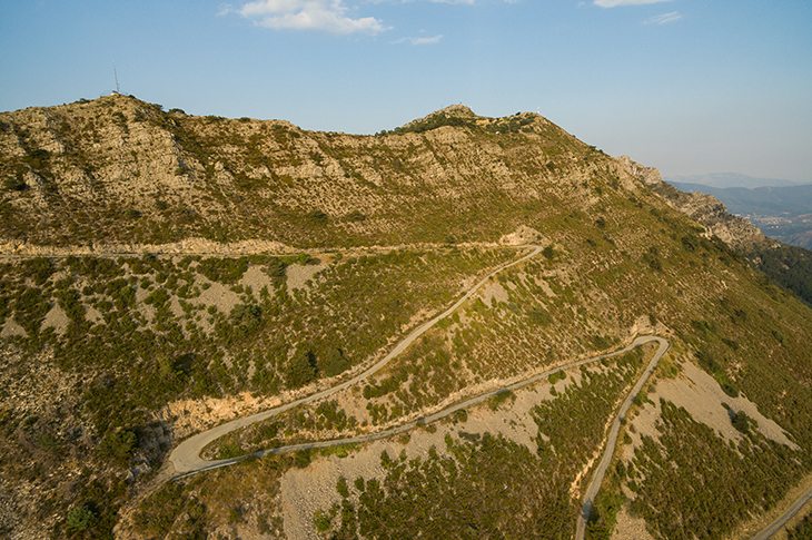
Although Mont Vial can seem ubiquitous, cyclists have to travel far into the backcountry to find the turning, which is tucked away somewhere between Toudon and Tourette-du-Chateau. Those who search will be rewarded, however, with a deserted, small, irregularly surfaced scrawl of switchbacks up the rocky mountain face. Perfection, in our eyes at least.
KEY INFO
Altitude: 1,549m
Length: 17.6km
Ascent: 1,195m
Average Gradient 6.8%
Max Gradient 12.5%
COL DE BROUIS
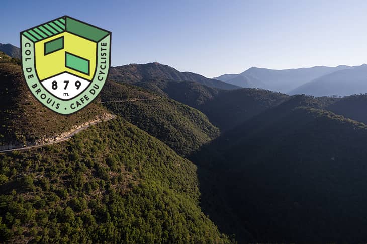
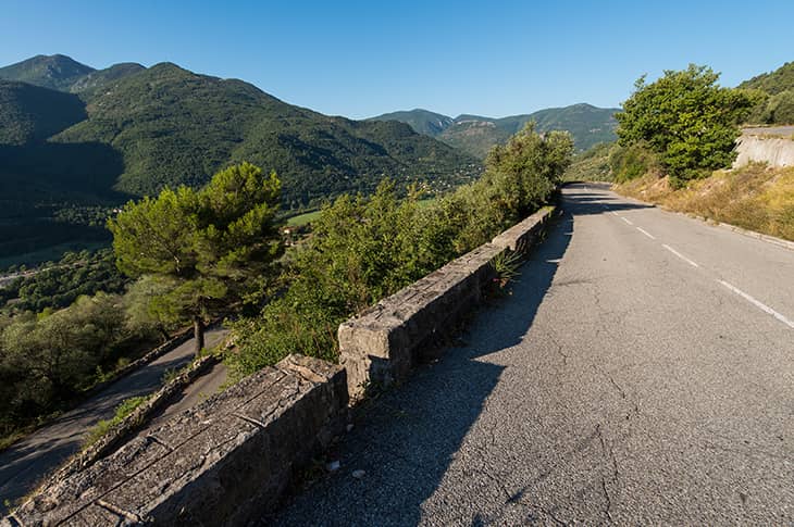
From Sospel the climb starts in the pleasant and open meadows in the valley of the small river Bevera. It ascends through deep gorges, though never too tight, and ends in open meadows again. It is as if the pass is higher than its 879m, and you have passed into the northern Alps.
KEY INFO
Altitude: 879m
Length: 11.9km
Ascent: 531m
Average Gradient 4.5%
Max Gradient 7.3%
MONT CHAUVE
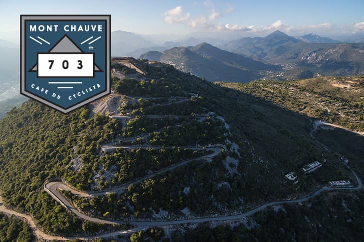
Mont Chauve is Nice’s hidden mountain. It is hiding in plain sight, sitting there just to the north, right above the city, but nevertheless it is hidden. The best time to come, perhaps, is early in the morning, to watch the sun rise over Italy; on clear days, from the fort, Corsica can be seen on the horizon. A hidden gem.
KEY INFO
Altitude: 703m
Length: 5.2km
Ascent: 411m
Average Gradient 7.9%
Max Gradient 11.0%
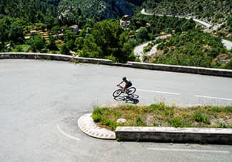
COL DE LA COLMIANE
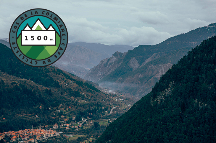
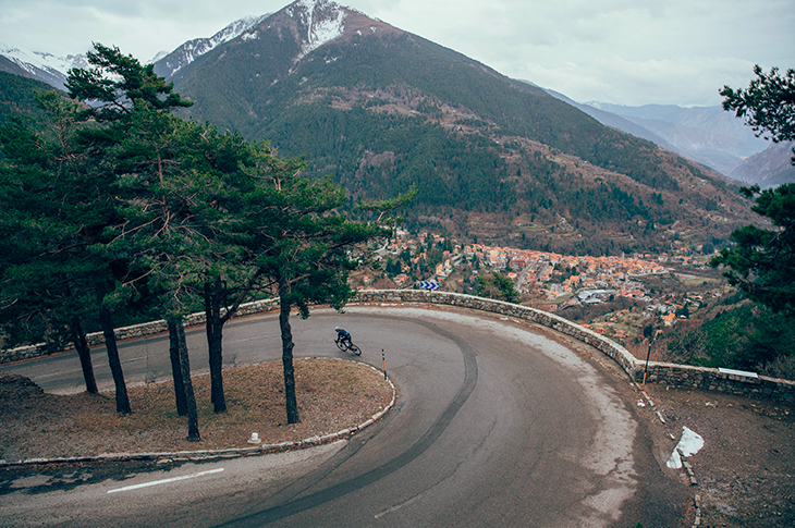
The name Colmiane originates from the alpine occitan dialect version - la Cuòla miana - and translates into ‘medium mountain’. But the Col de la Colmiane is no average climb. There is a ski station at the top, high peaks all around and the western side measures 16.3km in length. It is a proper mountain.
KEY INFO
Altitude: 1,500m
Length: 16.3km
Ascent: 970m
Average Gradient 6.0%
Max Gradient 9.4%
BADGES FOR COLS
We've created a collection of badges in celebration of iconic climbs near and far. All you have to do is ride the col and claim your free badge.
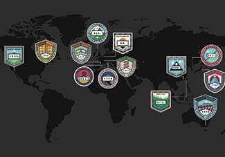
MONTAGNES DU MONDE
Explore some of the most celebrated cycling climbs globally. And a few less celebrated but no less good.
BADGES FREQUENTLY ASKED QUESTIONS
Not sure how to get started on your badge collection? Having trouble uploading rides? Our FAQ page has got you covered.
BADGES HIGH FIVE
Kick start your badge collection. Claiming five cols in one ride means lots of distance and plenty of elevation, but when you're riding in the Alpes Maritimes you wouldn't want it any other way.